
Trees and shrubs are an important part of the urban and rural environment. They contribute to local amenity, urban cooling, increased biodiversity, habitat, air and water quality and soil stability. Unfortunately, trees and shrubs are not always compatible with critical infrastructure such as buildings or underground services such as sewers, drains or water supply pipes.
Westernport has produced this guide to assist in choosing the appropriate planting location for trees, shrubs and grasses to help reduce potential damage and flood risk.
About this guide
This guide provides general information for proposed plantings near Westernport Water’s utility installations only. The information contained herein does not constitute consent, nor does it preclude the need to obtain relevant approvals under other legislation, such as under the Special Building Overlay or Land Subject to Inundation Overlay.
Key points
Inappropriate planting near Westernport Water assets can:
- Damage buildings and block pipes
- Increase flood levels
- Cause critical water supply failures
- Damage levee and retarding basin embankments
- Block maintenance and emergency access
Westernport Water seeks to balance asset protection and maintenance with the natural environment, aesthetics and biodiversity.
Where does this guide apply?
This guide gives advice on the types of planting which may be appropriate near underground pipes, associated structures, floodways, flood plains, retarding basins and levee banks. Please note that not all structure types have been listed.
Please note that this is intended as a helpful guide but does not claim to be comprehensive. If any plant on your property interferes with our water or sewer mains, we have the legal right to remove it under the Water Act 1989.
Vegetation types and offset distances
For advice relevant to your situation, please click on the relevant link below.
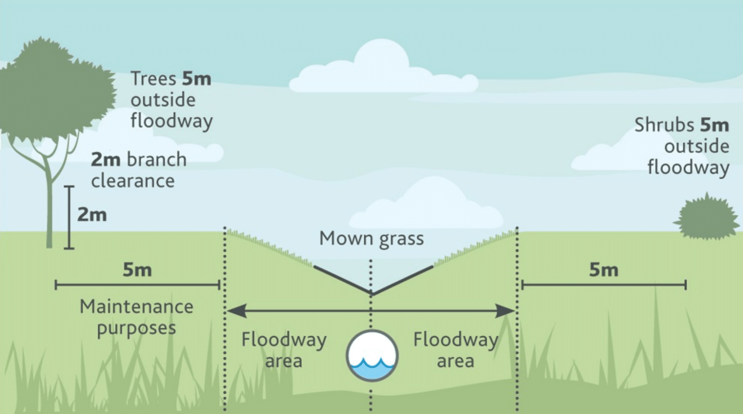
Planting on floodways or flood plains
The diagram below show minimum offset distances for each vegetation type:
- Mown Grass: up to 30cm in height
- Ground cover/Sedges: up to 1.5m in height
- Shrubs: 1.5m–4m high
- Trees: 4m and above
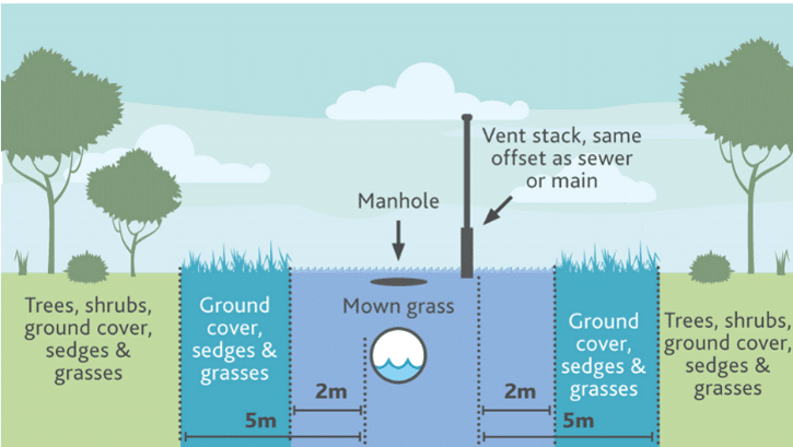
Planting on underground drains, water mains or sewers and associated infrastructure
The diagram below shows minimum offset distances for each vegetation type:
- Mown Grass: up to 30cm in height
- Ground cover/Sedges: up to 1.5m in height
- Shrubs: 1.5m–4m high
- Trees: 4m and above
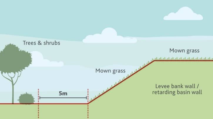
Planting on levee banks
The diagram below shows minimum offset distances for each vegetation type:
- Mown Grass: up to 30cm in height
- Ground cover/Sedges: up to 1.5m in height
- Shrubs: 1.5m–4m high
- Trees: 4m and above
Diagram 3: Levee bank
Suitable indigenous plants for planting
This list is intended as a general guide, please consult your local native plant nursery for specific advice for your location.
Page updated 8 July 2026